
74 Dead in UP, Delhi Bracing for 45°C, and Monsoon Knocking Early - India's Weather Just Got Very Serious
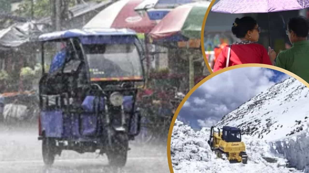
Wednesday, May 13th was one of the deadliest weather days Uttar Pradesh has seen in recent memory. Storms and rain tore through the state, claiming 74 lives across various districts in a single day. And while UP is now expected to dry out, the heat that follows may bring a different kind of danger. Meanwhile, the rest of the country is navigating everything from hailstorms in the hills to early monsoon signals in the south.
Here is the full picture, state by state.
Uttar Pradesh - From Deadly Storms to Scorching Heat
The storms that killed 74 people across UP on Wednesday were triggered by a specific set of atmospheric conditions. Meteorologist Atul Kumar Singh explained that a cyclonic circulation in the lower troposphere over northwestern UP, combined with easterly winds from southern Rajasthan and westerly winds in the mid-troposphere, created the perfect setup for intense thunderstorms.
That system has now largely moved on. Starting May 14th, UP is expected to remain mostly dry — but the relief from rain brings no real comfort, because temperatures are set to climb sharply in its place.
Lucknow is looking at a maximum of 39°C and a minimum of 27°C on May 14th, with no rain expected. Kanpur, Agra, Varanasi, and Bareilly are all in a similar position. The Bundelkhand region could see temperatures touch 45°C today, and a fresh heatwave is anticipated across southern UP in the days ahead. After yesterday's tragedy, residents now face a different kind of threat from the same weather system's aftermath.
Delhi - Dust Storm, Rain, and a Heatwave Warning for May 18th
Delhi got hit with rain and a dust storm on Wednesday, offering brief but messy relief from the heat. For Thursday, the forecast shows a maximum of 38°C and a minimum of 27°C, with cloudy skies persisting.
The more alarming figure, however, is for May 18th. The IMD has issued a heatwave alert for Delhi, with the maximum temperature expected to reach 45°C. That is extreme heat by any measure, and residents — particularly those working outdoors, the elderly, and children — should start preparing for that window now.
The Mountains - Rain, Snow, and Strong Winds
For those in or travelling through the northern hill states, caution is advised over the next couple of days.
Jammu & Kashmir, Ladakh, and Himachal Pradesh are expected to see light to moderate rain along with snowfall at higher elevations on May 15th and 16th. Winds of 30 to 50 kmph are forecast during this period. Uttarakhand is under a bad weather alert through May 14th.
If you have travel plans involving mountain roads or high-altitude areas this week, check local conditions carefully before heading out.
Punjab, Haryana, Chandigarh and Rajasthan
Punjab, Haryana, and Chandigarh can expect light rain with thunderstorms and strong winds on May 14th. Parts of Rajasthan will continue to see rain through May 17th. These won't be extreme events in most areas, but gusty winds accompanying the showers can still cause disruption to travel and outdoor activities.
Northeast India - Heavy Rain Alert in Force
The northeast is dealing with some of the most intense weather in the country right now. An alert for heavy to very heavy rainfall has been issued for Arunachal Pradesh, Assam, and Meghalaya. Torrential rain is also expected in parts of Tripura and Arunachal Pradesh.
Assam and Meghalaya are forecast to receive rain between May 14th and 17th, while Nagaland, Manipur, Mizoram, and Tripura are under rain watch through May 17th. Strong winds reaching 40 to 50 kmph are expected across many areas of the region.
Bihar, Jharkhand and Odisha - Thunderstorms With Dangerous Winds
Eastern India is in for a rough stretch. Bihar, Jharkhand, and Odisha are all expecting rain accompanied by thunderstorms, lightning, and strong winds of 30 to 60 kmph. In some areas of Bihar and Jharkhand, wind speeds during thunderstorm events could reach 70 kmph — well above what's needed to bring down trees and disrupt power supply.
Residents in rural areas with weak structures or open agricultural land should take these warnings seriously.
West Bengal, Sikkim and the Andaman Islands
Heavy rain is expected in West Bengal and Sikkim through May 16th. The Andaman and Nicobar Islands are under a continuous rainfall forecast all the way through May 19th — an extended wet period that aligns with the approaching monsoon activity in that region.
South and Central India - Early Monsoon Signals
Here's the significant meteorological development that will shape India's weather in the weeks ahead. Conditions are becoming favourable for the southwest monsoon to advance into parts of the southern Bay of Bengal, the Andaman Sea, and the Andaman and Nicobar Islands around May 16th. This is the first concrete signal of the 2026 monsoon beginning its northward journey.
In South India, Kerala, Andhra Pradesh, and Karnataka are expected to see rain, thunderstorms, and strong winds through May 17th. Tamil Nadu, Puducherry, Karaikal, and Lakshadweep are under active weather conditions through May 14th. Lightning and gusty winds are also expected across parts of Telangana and Karnataka.
In Central India, Chhattisgarh is looking at thunderstorms and rain through May 17th, with similar conditions in parts of Madhya Pradesh and Vidarbha.
Stay Safe — What You Should Do Right Now
If you're in UP's heatwave belt, stay hydrated and avoid outdoor exposure between noon and 4 PM in the coming days. Delhi residents should prepare for the May 18th heatwave alert with adequate water, cool spaces, and by checking on elderly neighbours and family members.
Those in Bihar, Jharkhand, and the northeast should stay away from open areas during thunderstorms and monitor local alerts as wind speeds in these events can be genuinely dangerous.
Keep an eye on IMD updates — the weather this week is moving fast and conditions can change within hours.