


Gurugram's Urban Area Expands by 64 Percent in a Decade: GMDA Geospatial Study Predicts Massive Growth by 2030
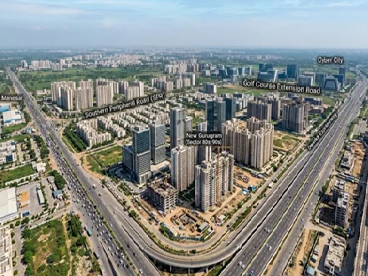
Gurugram is witnessing unprecedented urban transformation, with its built-up area surging by an impressive 64 percent over the past ten years. According to a comprehensive geospatial study conducted by the Gurugram Metropolitan Development Authority (GMDA), the city's developed urban sprawl has expanded from 102.50 square kilometers in 2015 to 168.20 square kilometers in 2025. Driven by rapid real estate development, economic prosperity, and enhanced infrastructural connectivity, this massive expansion is projected to accelerate even further as the city approaches 2030, necessitating proactive and data-driven civic planning.
Data-Driven Smart Planning for Future Infrastructure
To keep pace with this exponential growth, the GMDA initiated a detailed geospatial (GIS) and satellite-mapping study to analyze shifting urban patterns and anticipate future civic demands. The insights gathered from this research will serve as the foundational roadmap for developing robust infrastructure, including expanded road networks, intelligent traffic management systems, stormwater drainage, uninterrupted drinking water supply, efficient sewerage networks, and upgraded public transport facilities.
GMDA Chief Executive Officer P.C. Meena emphasized that data-driven planning is vital for fast-growing metropolises. By accurately assessing how and where the city is expanding, authorities can prioritize development projects, optimize resource utilization, and deliver world-class civic amenities to build a future-ready, sustainable urban ecosystem.
Advanced Satellite Mapping and High-Accuracy Insights
Shedding light on the technological framework of the research, Dr. Sultan Singh, Senior Scientist and Head of the GIS Section at GMDA, revealed that the study integrated high-resolution satellite imagery, advanced machine learning models, and meticulous statistical analysis. This enabled experts to map Gurugram's urban sprawl with an exceptional accuracy rate of over 92 percent, providing reliable, ground-truth data regarding land-use changes across the district.
Growth Corridors Driving New Gurugram's Expansion
The GMDA report highlights that the vast majority of Gurugram's urban growth has concentrated heavily around key transportation arteries and economic lifelines. Prominent growth corridors fueling this expansion include:
Dwarka Expressway
Southern Peripheral Road (SPR)
National Highway-48 (NH-48)
Golf Course Extension Road
Sohna Road and New Gurugram
Major commercial hubs like Cyber City, Udyog Vihar, and IMT Manesar
With urban expansion projected to scale up exponentially along these corridors by 2030, the GMDA report underscores the urgent need for integrated land-use policies, robust public transportation networks, optimized water resource management, and strict environmental and ecological safeguards to ensure sustainable growth for the millennium city.



_458138497_351x234.jpg)