

 Ziya
Ziya Share
Share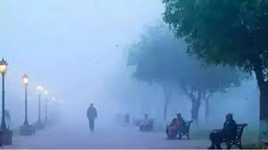
If you are currently in Uttarakhand or planning a trip to the hills, it’s time to stay indoors and stay safe. The India Meteorological Department (IMD) has issued a Yellow Alert for the state, predicting a 48-hour period of intense weather activity driven by an active Western Disturbance.
High-Alert Zones
The weather department has specifically flagged five districts for potential "nature’s fury":
Uttarkashi
Rudraprayag
Chamoli
Bageshwar
Pithoragarh
In these areas, heavy snowfall is expected at high altitudes, while lower and middle-level regions will likely face heavy rainfall and thunderstorms.
What to Expect
Lightning & Gusty Winds: Residents and travelers are warned of frequent lightning strikes and high-velocity winds. The IMD advises against outdoor activities during peak storm periods.
Temperature Drop: With rain and snow lashing the state, a significant dip in temperature is expected, bringing back the biting cold across both the hills and the plains.
Travel Disruptions: Snow accumulation on high-altitude roads (like the routes to Gangotri and Yamunotri) may lead to road closures and traffic jams. An avalanche warning is also in place for certain sensitive zones.
Light Rain in Cities: Even the plains and valley areas like Dehradun, Haridwar, and Nainital aren’t completely spared, with predictions of light drizzling and overcast skies.
Looking Ahead
While the next 48 hours (Feb 2-3) are critical, the weather is expected to stabilize by February 4th. From Feb 4 to Feb 6, conditions will likely remain dry and clear, though the residual cold will linger.
Safety Tip: If you are driving in hilly terrain, keep an eye on local advisories. Avoid high mountain passes during the evening and carry adequate warm clothing and emergency food supplies.

_1412932328_100x75.jpg)